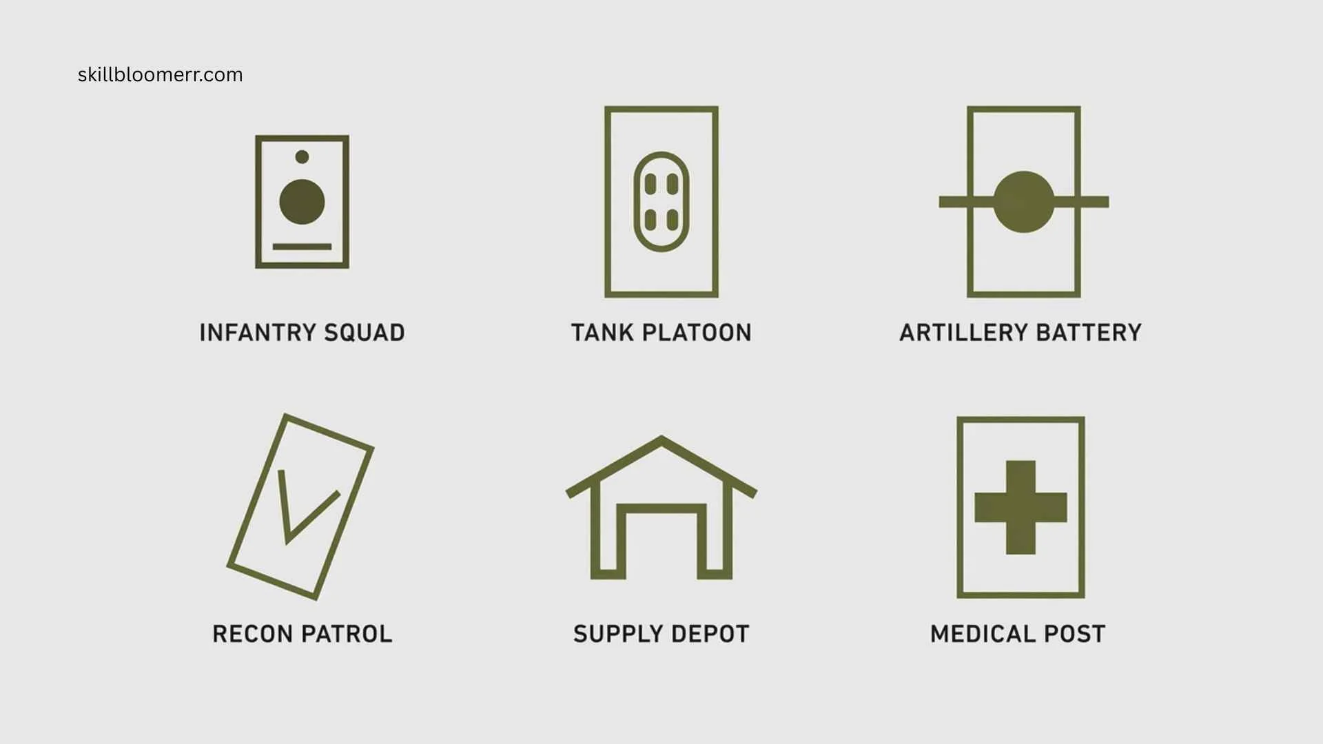
Army map symbols are visual signs used on military maps to communicate information quickly and accurately. They show the location of troops, equipment, terrain features, obstacles, boundaries, and important operational details without requiring long written explanations.
Understanding army map symbols is essential for soldiers, military planners, map readers, historians, outdoor professionals, and anyone interested in how military forces interpret terrain. These symbols appear on topographic maps, tactical maps, operational planning documents, and navigation charts.
Military map symbols transform complex battlefield information into a simple visual language. From infantry positions and artillery units to bridges, roads, and enemy locations, each symbol provides important information that helps commanders make decisions and plan movements.
Quick Meaning of Army Map Symbols
Army map symbols are standardized graphic signs used by military organizations to represent units, equipment, terrain features, and tactical information on maps. They help military personnel understand battlefield conditions, plan operations, and communicate locations clearly without confusion.
Army Map Symbols Overview Table
| Field | Information |
| Symbol Name | Army Map Symbols |
| Primary Meaning | Visual representation of military units, objects, and terrain information |
| Category | Military cartography and tactical communication |
| Origin | Developed through military mapping traditions |
| Civilization or Culture | Used by modern armed forces worldwide |
| First Known Use | Military maps have existed for centuries, but standardized symbols developed mainly in the modern era |
| Common Usage | Tactical maps, operational planning, navigation, intelligence reports |
| Modern Meaning | A universal visual language for military information |
| Related Symbols | NATO military symbols, tactical symbols, topographic map symbols |
What Do Army Map Symbols Mean?
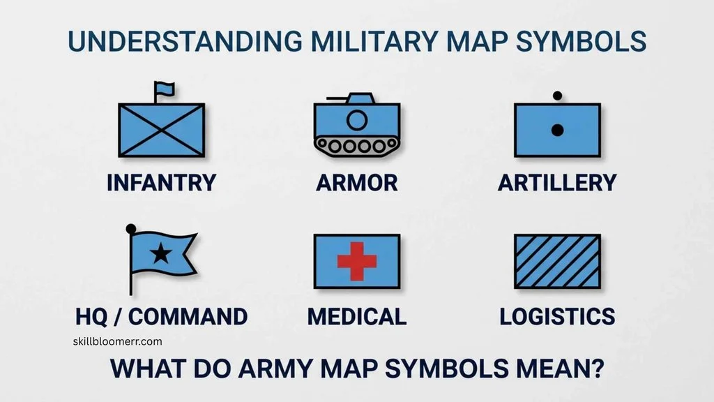
Army map symbols represent different military and geographic features that are important for planning and operations. Instead of writing descriptions, military maps use simple icons, shapes, colors, and labels to communicate information.
For example:
- A symbol may show the position of an infantry unit.
- Another may represent artillery, armor, aviation, or logistics units.
- Different markings may identify friendly forces, enemy forces, or unknown forces.
- Terrain symbols show mountains, rivers, roads, buildings, and obstacles.
The main purpose of these symbols is speed and accuracy. In military situations, decisions often need to be made quickly. A clear symbol system allows commanders and soldiers to understand a map at a glance.
Military map symbols usually follow standardized systems such as NATO military symbology, allowing different allied forces to understand the same information.
History and Origin of Army Map Symbols
Early Military Mapping Traditions
Military maps have been used for thousands of years. Ancient civilizations such as the Romans created maps to support military campaigns, road construction, and territorial expansion.
Early military maps were often simple drawings showing:
- Roads
- Rivers
- Settlements
- Fortifications
- Strategic locations
However, these maps lacked a universal symbol system. Different armies used their own methods for marking important locations.
Development of Standardized Symbols
As warfare became more complex, armies needed a consistent way to communicate information. During the 19th and 20th centuries, military organizations developed more formal mapping standards.
The growth of:
- Artillery systems
- Mechanized warfare
- Air operations
- Intelligence gathering
created the need for detailed tactical symbols.
Modern military symbols became especially important during World War I and World War II when large armies needed to coordinate thousands of units across different regions.
NATO Military Symbol System
Today, many countries use NATO-based military symbols. These symbols provide a common language between allied forces.
The system allows military personnel from different nations to understand:
- Unit types
- Operational roles
- Equipment locations
- Command structures
This standardization improves communication during multinational operations.
Symbolism and Interpretation of Army Map Symbols
Army map symbols are not symbolic in the cultural or religious sense. Their meaning comes from military standards, visual communication, and practical design.
Traditional Meaning
Traditionally, military symbols represented:
- Organization
- Strength
- Position
- Movement
- Control
A symbol on a map could indicate where a unit was located, what type of unit it was, and what role it performed.
Modern Meaning
Today, army map symbols represent information networks. They combine location data with operational details.
Modern military maps may include information about:
- Friendly forces
- Threat locations
- Supply routes
- Defensive positions
- Mission objectives
Positive Interpretations
Military symbols can represent:
- Organization
- Strategy
- Cooperation
- Planning
- Communication
They show how complex information can be simplified into an understandable format.
Negative Interpretations
In conflict situations, these symbols may represent:
- Areas of danger
- Enemy activity
- Military threats
- Battle locations
Their meaning depends on the context in which they are used.
Cultural Significance of Army Map Symbols
Military map symbols are used internationally, but their interpretation can vary slightly between countries.
United States Military Usage
The United States Armed Forces use standardized military symbols for:
- Army operations
- Joint military planning
- Intelligence analysis
- Training exercises
These symbols help soldiers interpret tactical information consistently.
NATO and Allied Forces
NATO members use shared standards to improve cooperation. A symbol representing an infantry unit or artillery unit should be recognizable across allied countries.
This shared system is important during:
- Joint exercises
- Peacekeeping missions
- International operations
Historical Military Cultures
Different armies throughout history developed their own mapping styles. Ancient armies, medieval forces, and early modern military organizations often used unique markings before modern standardization.
Scientific or Technical Meaning of Army Map Symbols
Army map symbols are part of the technical field of cartography and geographic information systems (GIS).
Military Cartography
Military cartography combines:
- Geography
- Surveying
- Mapping technology
- Data visualization
Symbols allow geographic information to be displayed efficiently.
Digital Mapping Systems
Modern military operations often use digital maps instead of traditional paper maps.
Digital military mapping systems may include:
- Satellite imagery
- GPS information
- Real-time updates
- Geographic databases
Symbols remain important because they allow users to understand large amounts of information quickly.
GIS and Data Visualization
Military symbols are closely related to GIS technology. GIS platforms use icons and layers to display:
- Terrain
- Infrastructure
- Units
- Environmental conditions
Where Army Map Symbols Are Used
Army map symbols appear in many military and professional environments.
Tactical Maps
Tactical maps show battlefield information such as:
- Unit positions
- Routes
- Defensive areas
- Objectives
Military Training
Soldiers learn map symbols during:
- Navigation training
- Field exercises
- Command courses
Historical Research
Military historians use symbols to understand:
- Battle movements
- Campaign strategies
- Unit locations
Emergency and Disaster Planning
Some mapping systems used for emergency response also use similar concepts for:
- Resource locations
- Team positions
- Operational zones
Outdoor Navigation
Although civilian hikers do not normally use military tactical symbols, understanding some map symbols can improve general map-reading skills.
Common Types of Army Map Symbols
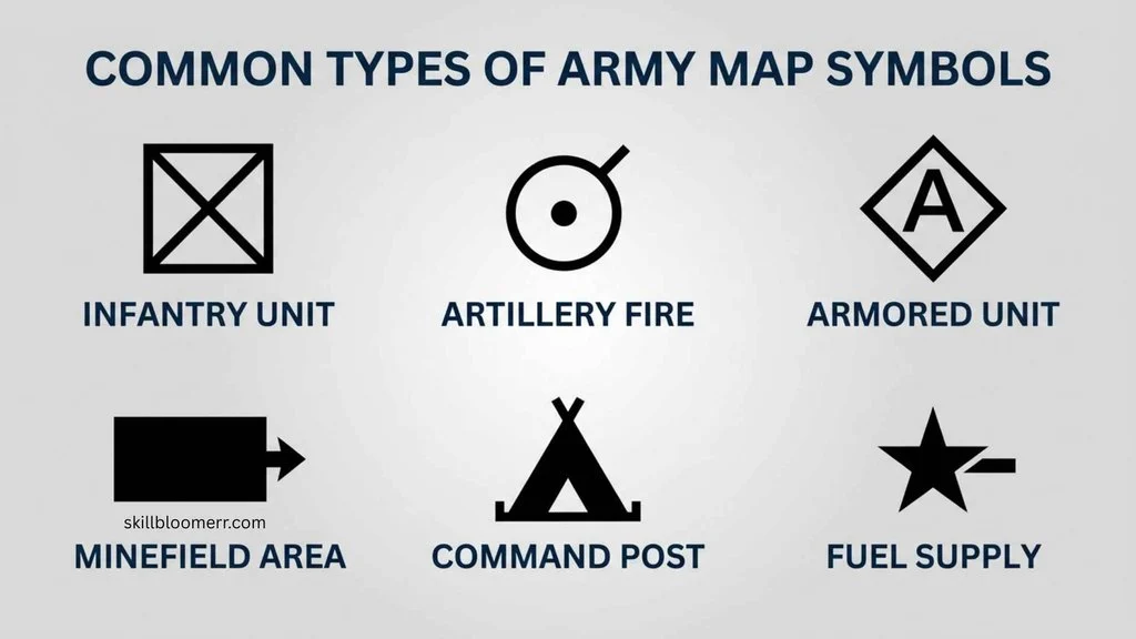
Unit Symbols
Unit symbols identify military organizations.
Examples include:
- Infantry units
- Armor units
- Aviation units
- Engineer units
- Medical units
The symbol design helps users recognize the type and role of a unit.
Equipment Symbols
Equipment symbols show important military assets such as:
- Vehicles
- Weapons systems
- Communication equipment
Tactical Graphics
Tactical graphics represent operational information, including:
- Boundaries
- Routes
- Areas of control
- Obstacles
Terrain Symbols
Terrain symbols show natural and human-made features:
- Rivers
- Roads
- Buildings
- Bridges
- Mountains
Common Variations of Army Map Symbols
National Variations
Different countries may use slightly different symbol designs. While many nations follow NATO standards, some maintain unique military mapping conventions.
Historical Variations
Symbols from older military maps may look very different from modern versions.
Historical maps often contain:
- Hand-drawn markings
- Different unit icons
- Older terminology
Digital Variations
Modern digital systems may modify symbols for:
- Computer screens
- Mobile devices
- Satellite displays
The goal remains the same: clear communication.
Common Misconceptions About Army Map Symbols
Myth: Every Military Symbol Is Secret
Not all military symbols are classified. Many standardized symbols are publicly available because they are part of general military documentation and training materials.
Myth: Symbols Have Universal Meanings Everywhere
Although many symbols follow international standards, meanings can vary depending on the military organization and map system.
Myth: Military Maps Only Show Enemy Positions
Military maps contain much more information, including friendly forces, terrain, logistics, and planning details.
Myth: Symbols Replace All Written Information
Symbols provide quick understanding, but they are usually combined with labels, numbers, coordinates, and notes.
Interesting Facts About Army Map Symbols
- Military symbols create a visual language.
They allow people from different backgrounds to understand complex information quickly. - NATO symbols support international cooperation.
Shared standards help allied forces communicate during joint operations. - Map symbols have evolved with technology.
Ancient hand-drawn maps have transformed into digital battlefield systems. - Colors often carry meaning.
Many military mapping systems use colors to distinguish different categories of information. - Symbols reduce communication errors.
A clear icon can prevent misunderstandings during important operations. - Military mapping influenced modern GIS technology.
Many principles of geographic data visualization developed from mapping needs. - Symbols must be simple but informative.
Designers balance easy recognition with detailed information. - Military maps combine geography and strategy.
They show not only where things are but also how forces may operate. - Different military branches use specialized symbols.
Army, navy, air force, and joint operations may require different information systems. - Map-reading skills remain important despite digital technology.
Soldiers still train with traditional navigation skills as backup methods.
Related Symbols
NATO Military Symbols
NATO symbols are the international standard used by many allied forces. They provide common methods for showing units, equipment, and activities.
Topographic Map Symbols
Topographic symbols represent physical features such as:
- Mountains
- Rivers
- Roads
- Buildings
Navigation Symbols
Navigation symbols help users understand:
- Direction
- Distance
- Routes
- Coordinates
Weather Map Symbols
Weather symbols communicate environmental information such as:
- Wind
- Clouds
- Storm systems
Frequently Asked Questions
What are army map symbols used for?
Army map symbols are used to show military units, equipment, terrain, and operational information on maps. They allow soldiers and commanders to quickly understand locations, movements, and battlefield conditions without reading lengthy descriptions.
Are army map symbols the same in every country?
No. Many countries use similar standards, especially NATO members, but some nations have their own variations. The basic purpose remains the same: creating a clear visual system for military communication.
What is the purpose of NATO military symbols?
NATO military symbols create a shared language between allied countries. They help different military forces understand unit types, equipment, and operational information during joint exercises and missions.
Can civilians learn army map symbols?
Yes. Civilians can study military symbols for historical research, map-reading skills, emergency planning, or general interest. However, military maps often contain specialized information beyond normal civilian navigation.
Why are symbols important on military maps?
Symbols save time and reduce confusion. Military operations often require fast decisions, and symbols allow users to understand large amounts of information quickly.
Do army map symbols change over time?
Yes. Symbols evolve as military technology changes. New equipment, digital mapping systems, and modern warfare methods require updated symbol standards.
What information can a military symbol show?
A military symbol can show the type of unit, location, status, equipment, operational role, or relationship with other forces depending on the mapping system.
Are military map symbols considered a language?
Yes. They function like a visual language because they use standardized signs and rules to communicate specific meanings.
How are army map symbols used today?
Today, army map symbols are used in paper maps, digital command systems, GIS platforms, satellite-based tools, and military planning software.
Key Takaways
- Army map symbols are visual tools used to communicate military information.
- They represent units, equipment, terrain, and tactical details.
- Modern symbols developed from centuries of military mapping practices.
- NATO standards help allied forces understand the same symbols.
- Symbols improve speed, accuracy, and decision-making.
- Military mapping combines geography, technology, and strategy.
- Meanings can vary depending on the country and mapping system.
- Digital technology has expanded how military symbols are displayed and used.
Conclusion
Army map symbols are an essential part of military communication and modern cartography. They transform complicated information about terrain, units, and operations into simple visual signs that can be understood quickly.
From ancient military maps to today’s digital battlefield systems, these symbols have evolved with technology while maintaining the same purpose: improving clarity and coordination. Understanding army map symbols provides valuable insight into military planning, geographic information systems, and the power of visual communication.

I’m Olivia Hartwell, a writer passionate about learning, personal growth, and practical education. I enjoy researching new ideas and sharing them in a way that feels easy to understand and useful. Through my work with SkillBloomerr, I aim to give readers reliable information they can apply in real life.
Books: Small Steps, Big Growth and The Curious Mind
 Ethan Calloway
 Nathaniel Brooks